Illinois Map Reference
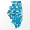 |
Map: Illinois |
|---|---|
| File Path: usa\states\counties\il.amap | |
| Bounds: (-91.5161285400391,42.5093612670898,-87.5078887939453,36.9867706298828) | |
| Default Projection: orthographic |
Map Built-In Data Table
| REGION_ID (K) | REGION_NAME (K) | CENTROID_X | CENTROID_Y |
|---|---|---|---|
| 17001 | Adams | -91.2186889648438 | 39.9808654785156 |
| 17003 | Alexander | -89.3218727111816 | 37.1630897521973 |
| 17005 | Bond | -89.4508438110352 | 38.8847484588623 |
| 17007 | Boone | -88.824779510498 | 42.3216571807861 |
| 17009 | Brown | -90.7190437316895 | 39.9755592346191 |
| 17011 | Bureau | -89.5193519592285 | 41.3697452545166 |
| 17013 | Calhoun | -90.7088661193848 | 39.1359558105469 |
| 17015 | Carroll | -90.0074195861816 | 42.0641059875488 |
| 17017 | Cass | -90.2914772033691 | 40.0025062561035 |
| 17019 | Champaign | -88.2004356384277 | 40.1421508789063 |
| 17021 | Christian | -89.2862167358398 | 39.5850009918213 |
| 17023 | Clark | -87.776309967041 | 39.3284206390381 |
| 17025 | Clay | -88.4821166992188 | 38.7623481750488 |
| 17027 | Clinton | -89.4296760559082 | 38.5804634094238 |
| 17029 | Coles | -88.2197265625 | 39.5327434539795 |
| 17031 | Cook | -87.8992919921875 | 41.8125667572021 |
| 17033 | Crawford | -87.7429161071777 | 39.0168838500977 |
| 17035 | Cumberland | -88.2415237426758 | 39.2768630981445 |
| 17037 | De Kalb | -88.7704124450684 | 41.8928203582764 |
| 17039 | De Witt | -88.8650321960449 | 40.1720905303955 |
| 17041 | Douglas | -88.2087936401367 | 39.7674407958984 |
| 17043 | Du Page | -88.0946655273438 | 41.8462753295898 |
| 17045 | Edgar | -87.7533493041992 | 39.6830387115479 |
| 17047 | Edwards | -88.0517272949219 | 38.4178237915039 |
| 17049 | Effingham | -88.5872650146484 | 39.0648002624512 |
| 17051 | Fayette | -88.982982635498 | 38.9790077209473 |
| 17053 | Ford | -88.2014389038086 | 40.702262878418 |
| 17055 | Franklin | -88.943717956543 | 37.9974155426025 |
| 17057 | Fulton | -90.1625556945801 | 40.4546279907227 |
| 17059 | Gallatin | -88.2059211730957 | 37.7519378662109 |
| 17061 | Greene | -90.3876113891602 | 39.3215789794922 |
| 17063 | Grundy | -88.4249038696289 | 41.2886848449707 |
| 17065 | Hamilton | -88.5412979125977 | 38.0847606658936 |
| 17067 | Hancock | -91.2098388671875 | 40.4202194213867 |
| 17069 | Hardin | -88.2457084655762 | 37.5104808807373 |
| 17071 | Henderson | -91.0024909973145 | 40.854341506958 |
| 17073 | Henry | -90.1521224975586 | 41.3681449890137 |
| 17075 | Iroquois | -87.8316802978516 | 40.7473602294922 |
| 17077 | Jackson | -89.4221267700195 | 37.7620830535889 |
| 17079 | Jasper | -88.1604232788086 | 39.0158252716064 |
| 17081 | Jefferson | -88.9277076721191 | 38.3009433746338 |
| 17083 | Jersey | -90.3815002441406 | 39.0914325714111 |
| 17085 | Jo Daviess | -90.2870483398438 | 42.3533401489258 |
| 17087 | Johnson | -88.8813819885254 | 37.4528636932373 |
| 17089 | Kane | -88.425724029541 | 41.938533782959 |
| 17091 | Kankakee | -87.8938674926758 | 41.1519832611084 |
| 17093 | Kendall | -88.4367332458496 | 41.59104347229 |
| 17095 | Knox | -90.2200012207031 | 40.9327011108398 |
| 17097 | Lake | -87.9821319580078 | 42.323034286499 |
| 17099 | La Salle | -88.8824234008789 | 41.2823390960693 |
| 17101 | Lawrence | -87.7127304077148 | 38.7158813476563 |
| 17103 | Lee | -89.2889671325684 | 41.7489643096924 |
| 17105 | Livingston | -88.5888175964355 | 40.8682270050049 |
| 17107 | Logan | -89.3809852600098 | 40.1238040924072 |
| 17109 | McDonough | -90.6847991943359 | 40.4578304290771 |
| 17111 | McHenry | -88.4525108337402 | 42.3236293792725 |
| 17113 | McLean | -88.869068145752 | 40.5202026367188 |
| 17115 | Macon | -88.9867706298828 | 39.8575592041016 |
| 17117 | Macoupin | -89.9286346435547 | 39.2624168395996 |
| 17119 | Madison | -89.9417152404785 | 38.8278656005859 |
| 17121 | Marion | -88.9237251281738 | 38.6521987915039 |
| 17123 | Marshall | -89.3534851074219 | 41.0377635955811 |
| 17125 | Mason | -89.9799270629883 | 40.2501201629639 |
| 17127 | Massac | -88.7116012573242 | 37.2028617858887 |
| 17129 | Menard | -89.790699005127 | 40.0356407165527 |
| 17131 | Mercer | -90.7700080871582 | 41.2007160186768 |
| 17133 | Monroe | -90.1367721557617 | 38.3037967681885 |
| 17135 | Montgomery | -89.4247512817383 | 39.2625370025635 |
| 17137 | Morgan | -90.2687873840332 | 39.7027282714844 |
| 17139 | Moultrie | -88.6441268920898 | 39.6228885650635 |
| 17141 | Ogle | -89.318431854248 | 42.0446338653564 |
| 17143 | Peoria | -89.7236747741699 | 40.746753692627 |
| 17145 | Perry | -89.3630676269531 | 38.0830116271973 |
| 17147 | Piatt | -88.6098251342773 | 40.0396614074707 |
| 17149 | Pike | -90.9752311706543 | 39.6202831268311 |
| 17151 | Pope | -88.5634841918945 | 37.338041305542 |
| 17153 | Pulaski | -89.0993041992188 | 37.2010135650635 |
| 17155 | Putnam | -89.31982421875 | 41.2134952545166 |
| 17157 | Randolph | -89.9023818969727 | 38.0141296386719 |
| 17159 | Richland | -88.1052665710449 | 38.7151279449463 |
| 17161 | Rock Island | -90.6130256652832 | 41.5568943023682 |
| 17163 | St. Clair | -89.987735748291 | 38.4388980865479 |
| 17165 | Saline | -88.5446624755859 | 37.7596168518066 |
| 17167 | Sangamon | -89.6106948852539 | 39.7535972595215 |
| 17169 | Schuyler | -90.5653839111328 | 40.1340618133545 |
| 17171 | Scott | -90.4735336303711 | 39.6593284606934 |
| 17173 | Shelby | -88.8070335388184 | 39.4347610473633 |
| 17175 | Stark | -89.8178520202637 | 41.1076107025146 |
| 17177 | Stephenson | -89.6620330810547 | 42.3505878448486 |
| 17179 | Tazewell | -89.5998497009277 | 40.5353565216064 |
| 17181 | Union | -89.28564453125 | 37.4718112945557 |
| 17183 | Vermilion | -87.741039276123 | 40.1850395202637 |
| 17185 | Wabash | -87.8199081420898 | 38.4082183837891 |
| 17187 | Warren | -90.6218681335449 | 40.8492851257324 |
| 17189 | Washington | -89.4293823242188 | 38.3632793426514 |
| 17191 | Wayne | -88.4277839660645 | 38.4340305328369 |
| 17193 | White | -88.1542282104492 | 38.0775394439697 |
| 17195 | Whiteside | -89.9451789855957 | 41.7586650848389 |
| 17197 | Will | -87.899600982666 | 41.4666938781738 |
| 17199 | Williamson | -88.932186126709 | 37.7352504730225 |
| 17201 | Winnebago | -89.1703071594238 | 42.3246479034424 |
| 17203 | Woodford | -89.2473373413086 | 40.7646865844727 |
![]()