South Carolina Map Reference
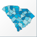 |
Map: South Carolina |
|---|---|
| File Path: usa\states\counties\sc.amap | |
| Bounds: (-83.3507995605469,35.2082405090332,-78.579719543457,32.0679626464844) | |
| Default Projection: orthographic |
Map Built-In Data Table
| REGION_ID (K) | REGION_NAME (K) | CENTROID_X | CENTROID_Y |
|---|---|---|---|
| 45001 | Abbeville | -82.4899673461914 | 34.2472038269043 |
| 45003 | Aiken | -81.6030349731445 | 33.5350894927979 |
| 45005 | Allendale | -81.3407135009766 | 32.9491348266602 |
| 45007 | Anderson | -82.6484222412109 | 34.5112133026123 |
| 45009 | Bamberg | -81.0089530944824 | 33.2291831970215 |
| 45011 | Barnwell | -81.4764747619629 | 33.2888259887695 |
| 45013 | Beaufort | -80.7252960205078 | 32.3853340148926 |
| 45015 | Berkeley | -79.902473449707 | 33.1877536773682 |
| 45017 | Calhoun | -80.7737236022949 | 33.6712417602539 |
| 45019 | Charleston | -79.865421295166 | 32.8590717315674 |
| 45021 | Cherokee | -81.616382598877 | 35.0107517242432 |
| 45023 | Chester | -81.1770973205566 | 34.6787738800049 |
| 45025 | Chesterfield | -80.1749649047852 | 34.5936031341553 |
| 45027 | Clarendon | -80.2088241577148 | 33.6929569244385 |
| 45029 | Colleton | -80.7271537780762 | 32.8403587341309 |
| 45031 | Darlington | -79.9759254455566 | 34.308385848999 |
| 45033 | Dillon | -79.3554039001465 | 34.4216480255127 |
| 45035 | Dorchester | -80.4384498596191 | 33.073860168457 |
| 45037 | Edgefield | -81.9149322509766 | 33.7572536468506 |
| 45039 | Fairfield | -81.0949668884277 | 34.3701858520508 |
| 45041 | Florence | -79.6911468505859 | 34.0408725738525 |
| 45043 | Georgetown | -79.3395843505859 | 33.461519241333 |
| 45045 | Greenville | -82.4565811157227 | 34.8446731567383 |
| 45047 | Greenwood | -82.0982131958008 | 34.1770687103271 |
| 45049 | Hampton | -81.1242485046387 | 32.790210723877 |
| 45051 | Horry | -78.9569892883301 | 33.9385166168213 |
| 45053 | Jasper | -81.0482559204102 | 32.4094257354736 |
| 45055 | Kershaw | -80.5763397216797 | 34.3385391235352 |
| 45057 | Lancaster | -80.6601753234863 | 34.7573413848877 |
| 45059 | Laurens | -81.9762153625488 | 34.4897899627686 |
| 45061 | Lee | -80.2323455810547 | 34.1607494354248 |
| 45063 | Lexington | -81.2422103881836 | 33.921329498291 |
| 45065 | McCormick | -82.3184547424316 | 33.8348121643066 |
| 45067 | Marion | -79.3474082946777 | 33.9954261779785 |
| 45069 | Marlboro | -79.6888809204102 | 34.5509872436523 |
| 45071 | Newberry | -81.6230773925781 | 34.2931118011475 |
| 45073 | Oconee | -83.0968017578125 | 34.7630481719971 |
| 45075 | Orangeburg | -80.794132232666 | 33.4402370452881 |
| 45077 | Pickens | -82.7096862792969 | 34.8433723449707 |
| 45079 | Richland | -80.9671173095703 | 33.9982376098633 |
| 45081 | Saluda | -81.7384452819824 | 33.9949779510498 |
| 45083 | Spartanburg | -81.9637260437012 | 34.8877182006836 |
| 45085 | Sumter | -80.2728271484375 | 33.9046478271484 |
| 45087 | Union | -81.6352996826172 | 34.6772041320801 |
| 45089 | Williamsburg | -79.7081260681152 | 33.5923767089844 |
| 45091 | York | -81.1786346435547 | 34.9888572692871 |
![]()